
(WDNews) – The National Hurricane Center has begun advisories on Potential Tropical Cyclone #6 (PTC 6), currently in the Bay of Campeche. The storm is expected to strengthen into a tropical storm as it moves north-northwest, before shifting north-northeast on Tuesday. Forecasters predict it will intensify further before nearing the Louisiana coast on Wednesday.
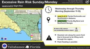 Image Source NWS
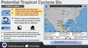 Image Source NWS
Regardless of its exact path, PTC 6 is expected to bring higher surf and increased rip current risks along the Gulf Coast starting Wednesday and continuing through at least Friday.
Heavy rainfall is also a concern, particularly in southeastern Alabama and the Florida Panhandle. A warm front is expected to move through the region by Wednesday, which could lead to localized heavy downpours. The Weather Prediction Center has issued a Slight Risk for Excessive Rainfall in the area, with the potential for heavy rain lingering through Wednesday night.